THE SANDS OF TIME...HOW TOPSAIL ISLAND WAS FORMED
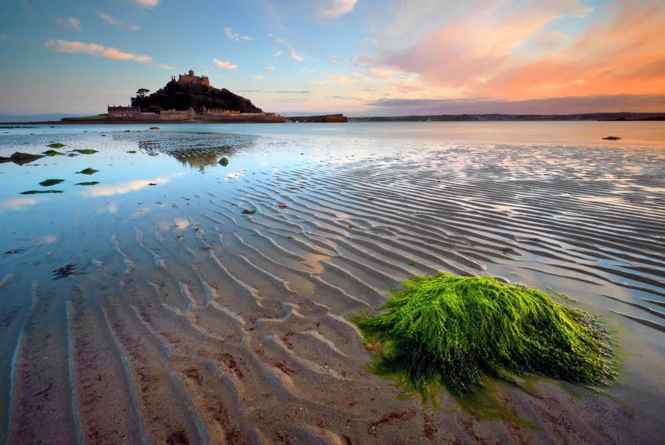
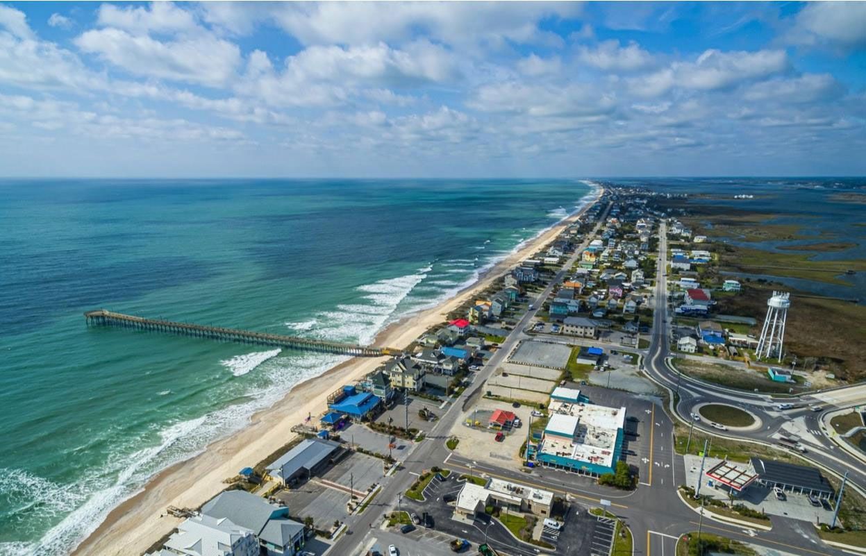
As you may already know, Topsail Island is a barrier island off the North Carolina coastline—specifically the coastal shores of Hampstead, Sneads Ferry and Holly Ridge, NC. Topsail Island spans about 26 miles in length—the second longest barrier island within the Onslow Bay section of North Carolina! Like a beautiful damsel floating on a raft in her pool, our lovely island rests gracefully on the Atlantic Ocean. The island is adorned with pristine beaches and maritime forests. However, history suggests that this island didn’t exist here since the beginning of time. It was formed in the process of time and is now home to people, and a variety of flora, and fauna. While here on a vacation, it’ll be interesting to know the origin of the land you walk on. If the sands could speak…the stories they’d tell! Stick with us and you will see just how this beautiful barrier island was born.
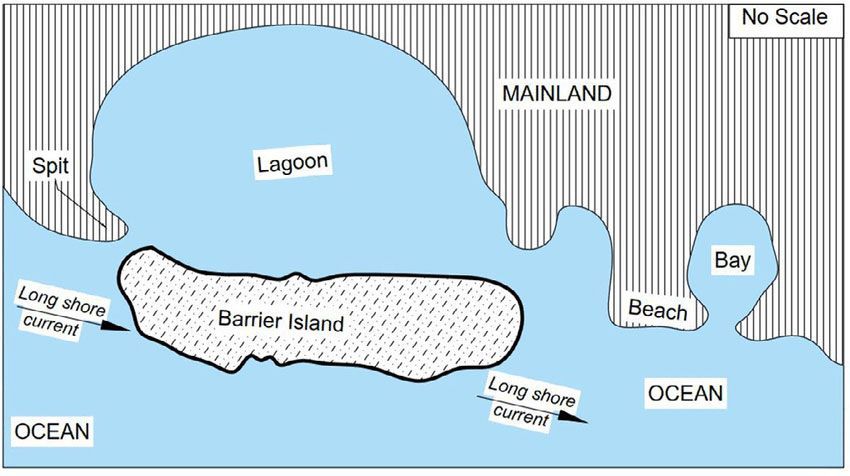
Barrier islands are elongated stretches of land that lie parallel to the coastline. They are usually quite strong but slim (< 1-3 km wide). There are three major theories about how barrier islands are formed. The most accepted is the Submergence Theory rendered by William John McGee, an American Geologist, in 1890. This theory suggests that in the Pleistocene era (2.85 M – 17,000 years ago), there were several massive glaciers, meaning the sea level was much lower—by about 85 meters—than it is today. However, as these glaciers began to melt, the sea level began to rise and the beach ridges on the shoreline were submerged. It didn’t stop there! As the sea level rose further, the ridges were pushed with the waves towards the mainland and were separated from the mainland by lagoons,
bays, tidal creeks, or sounds.
The other theories are the Offshore Bar Theory and the Spit Accretion Theory. The Offshore Bar Theory was the first theory to be rendered. It came up in 1845 by Jean- Baptiste Élie de Beaumont (Ha! If you think that’s a long name, believe us, that is only the short version of the name; there is more!). He was a French Geologist who suggested that
the waves approaching the coastline had deposited sand at the ocean floor, forming a sand bar and over time it accumulated till it reached the surface of the ocean. As more sand was deposited over time, the barrier island was formed, and separated from the mainland by a lagoon, creek, sound, or bay.
Sketch by Mr. Chukwuma John Okolie and his team
The Spit Accretion Theory was brought about in 1885 by Grove Karl Gilbert, an American Geologist. A spit refers to a stretch of the beach beyond the headland and out to the sea. It is formed by a longshore drift where the prevailing winds and the sea waves cause the beach material to be carried along the shore in a zigzag fashion until an extended stretch of beach material projects out to sea but remains joined to the mainland at one end. Gilbert
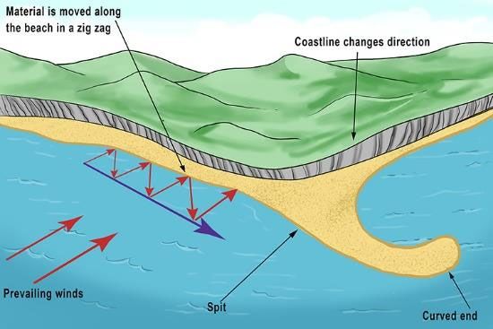
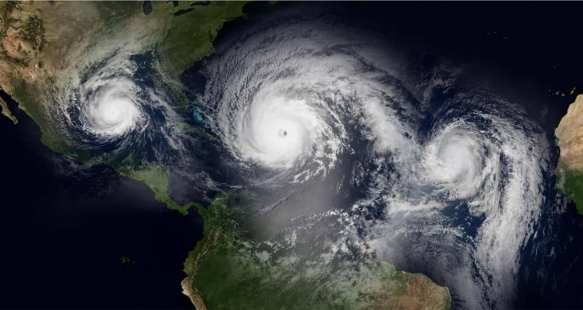
believed that over several thousand years, the spit will get larger and longer and eventually, when a heavy storm or large hurricane hits, its connection to the mainland is broken off.
You may be surprised to learn that barrier islands are constantly changing but once you learn how the transformation process works, it will make a lot more sense. There are four major factors that cause the island to change shape over time. Let us start with the Long Shore Drift. The Long Shore drift is what we mentioned in the formation of a spit. The prevailing wind causes the waves to hit the beach at an angle and then they pick up
sediments from the beach and then draw back into the sea at a right angle. The waves then pick up the sediments, hit the shores and draw back again in the zig-zag fashion. As it occurs repeatedly, the beach material is washed off the beach and deposited elsewhere and this causes the beach to change shape over time.
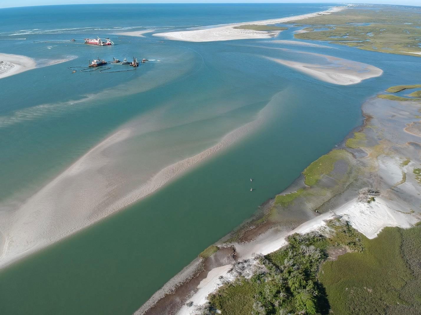
Another way barrier islands change shape is through Inlet Migration. An inlet is an indentation in the shoreline. It is usually a long and narrow water channel between a closed bay and the open sea. Topsail Island has two inlets: the New River Inlet at its north and New Topsail Inlet at its south. Inlets migrate because of longshore drifts. As longshore drift occurs, sediments are added to the upstream part of the inlet causing it to grow. The downstream side, however, is eroded. This causes a migration of the inlet, but the size however is maintained.
Copyright © 2021 MH Sub I, LLC dba Internet Brands.
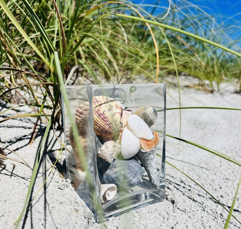
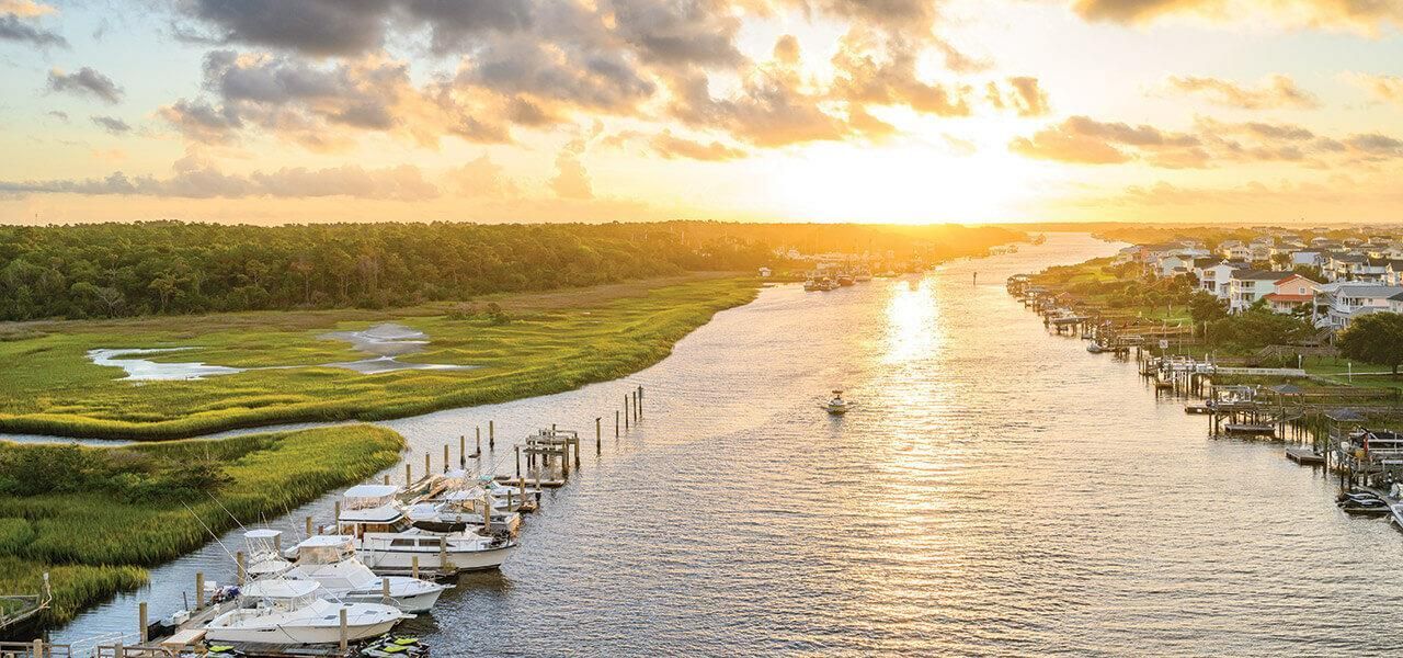
The third transformation factor is the Summer-Winter Change. Seasonal variations in the prevailing wind direction and speed cause the beach to change shape and size between winter and summer. During the winter, prevailing winds are from the Northeast and the wind speed is greater due to the increased temperature difference between the poles and the equator. The warm air from the equator rises and is then replaced quickly by the cold air emerging from the poles. This causes stronger wave energy that pulls off some of the beach material and stores them offshore in sand bars. The beaches in winter are therefore much smaller. During summer, however, the prevailing winds are from the Southwest. The wind speed is less, and the waves are gentler and more regular. The waves then take the sand from the offshore bars back to the beach and this causes the summer beaches to be much wider and more enjoyable! The cycle is repeated as the seasons change. The fourth transformation process is called Over wash fans. They occur during major storms and are quite important because they cause major changes to the shape and location of the island. They move the island landward (toward the coastline). During this process, sand is moved all the way from the beach front to the back of the barrier island. Now it makes more sense to you why the island is constantly changing. As you can imagine, barrier islands have different zones or environments as you go from the shore face to the back of the island where the lagoon, bay or sounds are formed. From the shore face, the first zone is the Shoreface sediments which is simply the beach area. It consists of the offshore sand bars, the beach ridges, runnels (water-filled troughs along the beach) and the beach berms. The next zone consists of the sand dunes which are crossbedded sand that form mounds of sand. They may only get flooded when there is a storm and in some cases some of the sand dunes may be run over by over-wash fans. The plants that may be present on the dunes are important as they help them maintain the dune shape. If you are visiting here, please do not walk on the plants so the dunes do not get destroyed. The next zone is the shrub forest with many shrubs, grasses, and bushes. This is followed by salt marshes: shallow water and organic-rich mud. The salt marshes are home to many crustaceans like oysters, crabs, snails, periwinkles, and birds like wading birds, ducks, diamondback terrapins, etc. The low tidal flats come next and are followed by the maritime forests. Finally, we get to the lagoon, bay or sounds which separate the barrier islands from the mainland. Topsail Island is separated from the mainland by several small sounds and channels that are part of the Atlantic Intracoastal Waterway.
Barrier islands are especially important to the mainland. They are critical to protecting the coastlines and ecosystems from harsh weather as in severe storm damage and flooding. The grasses and beach dunes on the islands absorb the shock from wave energy before it gets to the mainland. In other words, like the name ‘barrier island’, it serves as a barrier or shield that protects the coastline of the mainland. Despite their slender appearance, they have protected the shorelines for centuries. Barrier islands also serve as a home to distinct species of wildlife. They do this by providing a safe environment for estuaries and marshes to form behind them. These areas also serve to purify the water. These islands are a huge blessing.
So which theory do you think relates the most to Topsail Island: The Submergence theory, the Offshore Bar theory, or the Spit accretion theory? Now that you know how barrier islands are formed and what you find on a barrier island, we bet your Geography teacher got nothing on you. Ha!