THE INTRACOASTAL WATERWAY OF NORTH CAROLINA
One of the most scenic attractions you’re likely to come across while touring the charming state of North Carolina is the Intracoastal Waterway. Gracefully flowing through nineteen states of the US, this massive waterway was created by both natural and man-made efforts. With an alluring scenery and a fascinating history, there is no debate against your visit to this spectacle. Questions then: How…When...and why was this beauty created? Grab some popcorn now as the story unfolds!
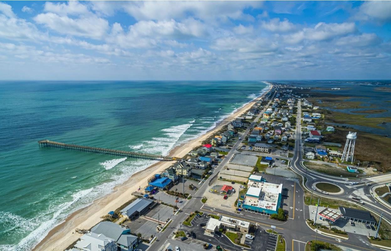
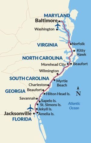
As the name gives away, The Intracoastal Waterway is a water route that lies within the North East and South Coasts of the United States. The ICW (as abbreviated) runs a whopping 3,000 miles from Boston, Massachusetts, southward along the Atlantic Seaboard, through the Southern tip of Florida, and then into the Gulf Coast before finally ending at Brownsville, Texas. The North Carolina Portion of the ICW commences its journey from North Landing River in the north, at the Virginia/North Carolina State Line and it continues southward to the Little River Inlet before ending its journey at the North Carolina/South Carolina State Line. As it runs the length of the North Carolina coast, it provides a passage between the mainland and some barrier islands like Hatteras Island and Holden Beach.
Illustrated by US River Cruises
HOW DID THIS IMPRESSIVE WATERWAY COME TO BE?
For several years prior to the waterway development, many traders and sea vessels had to take long trips through the Atlantic Ocean to access multiple parts of the country. As expected, these journeys exposed the ships to significant damage. Matter of fact: in the 1500s, about 600 shipwrecks took place at the Diamond Shoals alone. The Diamond Shoals are an evershifting cluster of underwater sandbars just off the Cape Hatteras coast and the Outer Banks shorelines. The sandbars are more or less hidden beneath the waves and the formation and depth of these sandbars change frequently depending on the local currents—the shipwrecks can be attributed to this. It was for this reason that some gave it the nickname ‘Graveyard of the Atlantic.’ It became obvious that there was a need for a much safer route than the Atlantic Ocean to access multiple parts of the country. The government began to take measures to improve the country’s natural transportation routes.
In 1802, the Senate requested that the Treasury Secretary, Abraham Alfonse Albert Gallatin, presents a plan for transportation development. Gallatin went hard at work and created a detailed plan covering the engineering and construction costs as well as the potential benefits the country would enjoy as a result, including lowered transportation costs. He noted the potential of the inland navigation system that the country possessed—there was an existing waterway from Massachusetts to Georgia but it was interrupted by four stretches of land. Gallatin, in his report, illustrated that these four stretches of land could be dredged to create new canals, making it possible for a sea vessel to travel by rivers, sounds, and a few canals from Boston, Massachusetts to Beaufort, North Carolina, and then to the Cape Fear River. The inland navigation would then be broken by a short ocean flow but would continue within the series of barrier islands off the coasts of South Carolina and Georgia.
Gallatin reckoned that it will cost approximately $3 million to create the four canals and just about $20 million for the entire scheme. He proposed that if $2 million is set aside from the annual Treasury surplus yearly, then it will take ten (10) years to complete the vision. When he presented his plan, President Thomas Jefferson did not buy the idea. Sadly, for this reason, Gallatin’s plan was not implemented. On the bright side, his idea became a reality…eventually! The plan set for ten years ended up spanning over a hundred years! With the War of 1812 and an increased need for improved water transportation, Gallatin’s proposal was reviewed but the execution was slow. Plans to create a waterway between the towns along northeastern North Carolina and Virginia were carried out and by 1829, the Dismal Canal was completed, running through northern North Carolina and the Great Dismal Swamp. It served well as a shortcut for many sea travelers but did not accommodate large vessels so a wider route, the Albermarle and Chesapeake Canal, was created parallel to the Dismal Canal and was completed in 1859.
After the Civil War (1861-1865), railroad transportation became more rampant. However, during World War I (1914—1918), there was an increased demand for bulk cargo transportation, and water transport posed a greater advantage in hauling bulk cargo. Congress then established the Federal Barge Lines to revive the waterway and transport bulk cargo by cheaper means. The Louisiana and Texas waterway construction began in the 1920s to further expand the waterway but the final affront for completing the Intracoastal Waterway came during World War II (1939— 1945). Many merchant ships carrying supplies were sunk off the East Coast by the Germans. It became a matter of urgency to have multiple states in the US reachable from the inland. To accomplish this, a waterway was then created between New Orleans, Louisiana, and Corpus Christi, Texas. That was the last straw for completing the waterway.
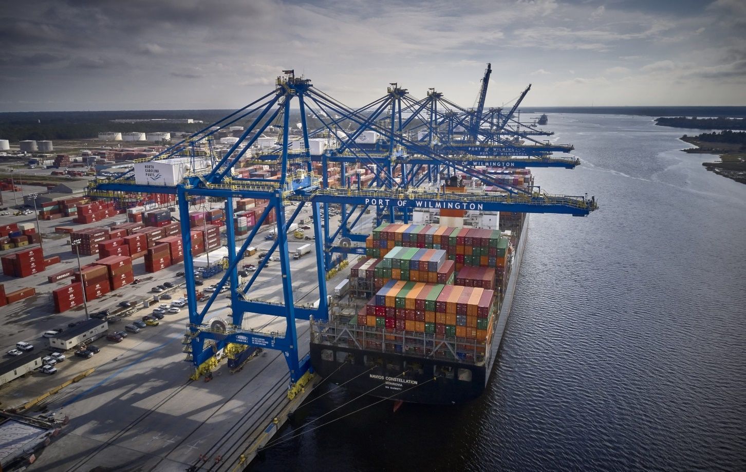
The North Carolina section of the waterway was built between 1914 and 1934. Its construction was conducted in three stages. The first route was aimed at connecting Norfolk, VA, to Beaufort, NC. The second route was made to connect the Albemarle and Chesapeake Canal to the North River. The last section extends from the Cape Fear River to the South Carolina line. In a short time after the completion of the North Carolina portion, its traffic became very heavy. Many merchants transported their cargo comprising mostly seafood, agricultural products, and petroleum. It also quickly became a recreational site for yachting. It was very crucial during World War II for transporting cargo through North Carolina waters without suffering the peril of German submarines waiting for the next US Ship to sink.
DID YOU KNOW?
The Intracoastal Waterway is a major part of ‘America's Great Loop,’. The Great Loop is a continuous waterway of about 6,000 miles that winds around the Eastern portion of the US and a part of Canada. It loops from the East Coast to the Gulf of Mexico and then runs back up through the central states before hitting the Great Lakes. Many recreational mariners love to travel around it and in fact, anyone who completes the Loop journey is officially named a ‘Looper’!
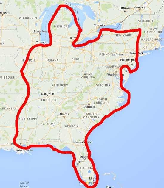
The Great Loop © Global Creation LLC
WHAT HAPPENS ALONG THE ICW TODAY?
The Intracoastal Waterway poses both economic and recreational benefits to the nation. It has prevented death and damage to many seafarers who would, otherwise, have been exposed to fatalities in the open ocean. Merchants today still use the waterway to transport cargo. Some large ships may still prefer to cruise the open ocean route but the smaller vessels of sea traders, recreational mariners, and commercial fishermen would rather stick to the inland. Traffic on the waterway is especially heavy during fall and springtime. ‘The Fall Migration’ is a term used to describe the dazzling array of sea vessels, both small and large, progressing southward to escape the winter in the North. In springtime, one can enjoy another spectacular view as these sea vessels trail their way back northward.
TIPS AND TRICKS FOR CRUISING THE ICW
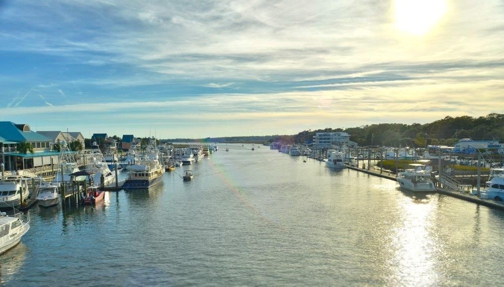
Today, most of the ICW cruisers are recreational sailors and you can be one of them. There few things you can note to help you have an enjoyable time cruising the ICW. If you do not have a boat, there are kayak rentals and fully-guided boat tours available to you. Unless you want to, you don't have to tour the entire North Carolina ICW route to make a memorable trip. Many visitors, fishermen, and locals take day trips to certain regions to enjoy the view and thrilling fishing experience. If you want to go fishing, the Albemarle sound is a great spot for angling. There is a variety of species you are very likely to find: Black Drum, Black Sea Bass, Bluefish, Butterfish, and even flounders, mullets, and sheepshead.
It is a great idea to keep the local towing numbers at hand while cruising. You should always travel on days with good weather and light winds to enjoy a smooth ride, however, if unexpected events like mechanical breakdown, running out of fuel, or engine overheating, occur while you’re on the move, just ring the towing numbers and they will be more than happy to help. There are several stations set up by the US Coast Guard and private companies like Boat US and Sea Tow. Feel free to ring ’em if you need ’em!
INCREDIBLE ATTRACTIONS AROUND THE ICW
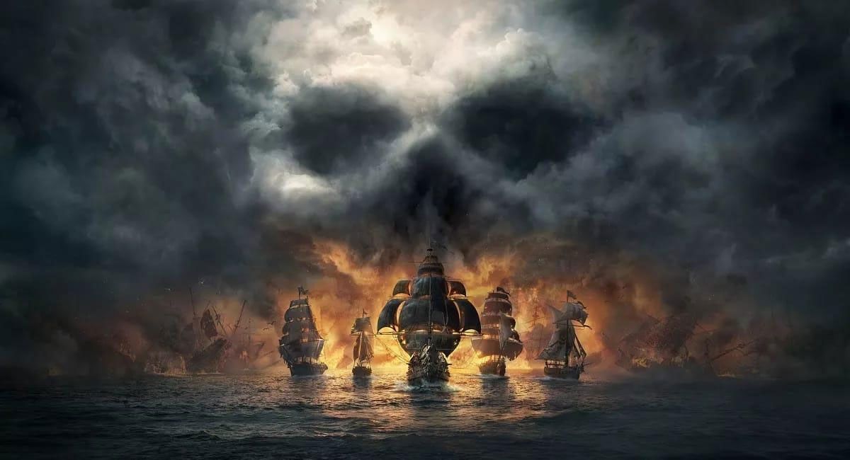
There are many towns and attractions worth taking a stop to explore while cruising the ICW. Along the way, you will see many restaurants and shops with great food and souvenirs to give you a memorable experience. Towns like Currituck, Jarvisburg, and Point Harbour are well-known for their signature barbecue joints. They also display fresh farmers' markets, vegetable and fruit stands, and golf courses. Along Dare County's East Lake, you would find wildlife reserves and refuges like the Emily and Richardson Preyer Buckridge Coastal Reserve, and Mattamuskeet National Wildlife Refuge. Lake Mattamuskeet offers an incredible bird-watching view. In fall and winter, thousands of tundra swans can be seen migrating from Alaska and Vancouver regions. Sometimes the lake appears to be covered in snow as these birds squawk and splash all over it. What a lovely view! Beaufort is well known as a pirate haven, especially for Blackbeard, one of the most famed pirates in pirate history. This makes Beaufort one of the most visited places in North Carolina. Feel free to visit The North Carolina Aquarium and NC Maritime seashell museum in Beaufort if you’d like.
The Intracoastal waterway can be explored and enjoyed in any which way. Even those who don’t want to hit the waters can enjoy the ICW. Some waterfront restaurants allow patrons to fish from the banks or just enjoy the view. If you’re up to the task, however, you can acclaim the title of a ‘looper’ and have something to brag about when you’re out with friends!