CAROLINA BAYS: AN ENIGMA OF NATURE
Over the past several years, many thrilling discoveries of nature have been made the fascinating Fault of Saint Andreas in California, the enthralling Chocolate Hills of the Philippines, the awe-inspiring Marble Caves of Chile, etc. But some things have puzzled the daylights out of researchers and geologists! They pose mysteries that elude explanations. Among these are the Carolina Bays. Several thousands of these landforms array the eastern Atlantic coastal plains of America. But what is so special about them? And what about them has confounded many researchers? You are about to be amazed.
WHAT ARE THE CAROLINA BAYS ANYWAYS?
Carolina Bays are a multitude of wetlands with characteristic oval-shaped depressions. Despite their name, they aren't bays at all and neither are they confined to the Carolinas. They are more like pocosins and some of them are
found in Delaware, Maryland, Virginia, and Georgia; many of them, however, are concentrated in the Carolinas. What's really striking about these bays are their numbers and the unique features. At least 5,000 of them have been identified along the Atlantic coastal plains. Some have been destroyed over time but at least a thousand of them still exist in the Carolinas.
The Carolina bays vary in size (from 30 feet to almost three miles across), but they all share distinct features. First is their shape; they all come in oval shapes that point in the same direction-the base at the northwest and the apex at the southeast. Next is their surface level; it is lower than the surrounding ground but they are encircled by sand rims raised above the surrounding ground. Also, they exhibit a soil texture that differs from the surrounding soil. Finally, their water supply is independent of rivers and other inflowing or outflowing water channels; their water is drawn from underground water or rainfall. The bays aren't obvious from ground level but when viewed from above, the egg-shaped mini craters come alive. But these bays that share similar features and exist in large numbers over a large area, cannot but make us ask one question: how exactly did they come about?
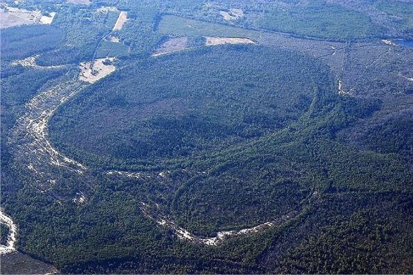
Two Carolina Bays. Photo from Wikipedia
WHAT DO WE KNOW ABOUT THEIR FORMATION?
At best, scientists have come up with hypotheses, researchers have made speculations, geologists have created theories, and many people have their beliefs, but here's the thing: no one is certain yet about how these uniquely shaped pocosins came about. But let's explore some of the ideas that have run so far. Some of the theories that were brought up have gone extinct for one reason or the other-some because they lacked substantial evidence, and some, well, they simply didn't make sense. One theory suggested that at a time when the region was submerged underwater, the holes were mined by underwater currents and eddies. Another theory suggested that the bays were once lakes that were elongated by magnetic forces from redeposited iron compounds. Some believed that the bays were once mammoth wallows. Some others even believed that the bays were fish nests made by large schools of fish. But when you consider these bays in their numbers-even before the thousands were discovered, many of them had already been disturbed unknowingly by man made forces-many of the theories just don't cut it.
One theory that was surmised for a while was that the depressions were created by meteor collisions over 12,000 years ago. It was devised by William Frederick Prouty; articles of his works were published in scientific journals of the 1950s. But it was considered to be too dramatic an event. Other scientists believed that an earthly event was more likely than a cosmic one because the crater sizes of the bays are more shallow than known impact craters. Also, no remnant meteorite fragments have been found in them. As such, this theory was considered implausible by some and as more investigations were carried out, other theories were surmised.
A theory that is currently being considered is the effect of both aeolian and lacustrine forces. Raymond T. Kaczorowski in 1976 suggested that the bays were once shallow lakes that were shaped by prevailing wind patterns. He believed that the sandy rims at the edges of the bays were consistent with bimodal wind patterns that occurred during the late Pleistocene Epoch-also known as the Ice Age. Some other geologists also believed that the oval shapes of the bays were created by the action of strong winds on the surface of the waters that caused circulatory currents at both ends of the bay. They believed that this same wind-water action created the shallow depressions of the bays. The peat then formed by decayed plant material cemented the sand below and allowed the bays to retain water. So, which theory strikes the best chord with you?
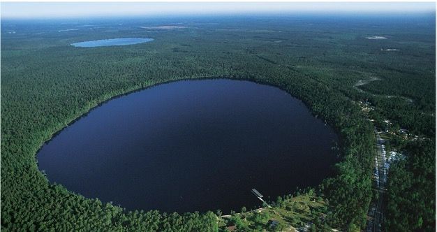
Water-filled bay. Photo by Our State Magazine
THE BAY ECOSYSTEM
We may not be certain of the formation of these bays but we do know for sure that we are thankful for their existence. Since these wetlands are mostly flooded or saturated with water, an anoxic environment is created in the soil, and the vegetation is adapted to the anoxic hydric soil. Also, their independence from rivers and water channels causes them to sometimes experience seasons of wet and dry, so the animals that thrive here are adapted to the variations in the water level. As such, they possess some of the most biologically diverse ecosystems there are.
The infestation of insects and reptiles in some of the bays has left only the bold and undaunted to explore them. A field survey of the Carolina Bays carried out from 1983 to 1988 revealed eleven ecosystems with thirty-six vulnerable species and twenty-three endangered species identified.
Threatened animal species that frolic in this habitat include salamanders, gopher frogs, and wood storks. You can also find turtles, herons, egrets, and mammals like opossums, raccoons, skunks, and deer. Some of the endangered plant species that thrive here include the venus fly traps, spoonflowers, pond spice, leatherleaf, and Canby's dropwort. Carolina bays are also inhabited by carnivorous plants like bladderworts, butterworts, sundews, and pitcher plants. Other delightful plant species you'd find flourishing here are water lilies, bald cypress, pond cypress, buttonbush, sweet bay, magnolia, maple, sweet gum, gallberry, etc-almost too many to list!
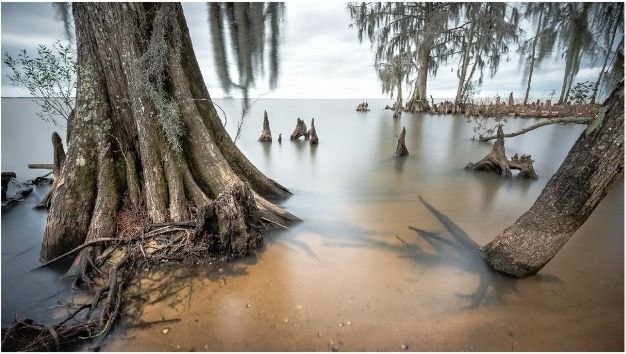
Knees of Cypresses. Shot by Curtis Cabana
BAYS OF THE CAROLINAS
Today, many of the bays exist as marshes, but a few of the larger ones remain undrained and exist as lakes. Some bays have been altered by various activities, mostly farming, because the peat in the soil serve as excellent agricultural grounds. Many of the bays are being used for various purposes.
Carvers Bay in South Carolina is a drained bay that is currently used for tree farming. During World War II, it was used as a range for bombing practice which caused it extensive damage. Woods Bay and Bennett's Bay, both in South Carolina, were designated a state park and Heritage Preserve respectively to preserve them in their pristine state as much as possible.
Of the bays that remain undrained, Lake Mattamuskeet and Lake Waccamaw are two of the most famous. Lake Mattamuskeet is a shallow lake (2-3ft in depth) located in Hyde County, North Carolina. It was named by the Algonquian Indians. It is the largest natural lake in North Carolina. Several attempts were made to drain the lake and access the rich soil beneath the water but eventually, they just gave up and chose rather to establish the Mattamuskeet National Wildlife Refuge there. The refuge became a famous migration site for geese, ducks, and tundra swans.
Lake Waccamaw is a large Carolina Bay located in Columbus County, North Carolina. It gets most of its water from surrounding swamps. Its lovely tea color comes from the organic matter from the decaying vegetation of the swamps. Certain species of fish are found only in or around the lake: the Waccamaw silverside, Waccamaw darter, and Waccamaw killifish. A diversity of mollusks, clams, and snails call this lake home. Alligators also live in the lake. The lake is currently managed by the Lake Waccamaw State Park. In 2008, scientists uncovered a whale fossil in the lake. They made efforts to restore its skull and they were successful-it is currently on display at Lake Waccamaw State Park. Some other thrilling discoveries were made in the lake: a 300-year-old Indian canoe, marine fossils, Waccamaw Siouan Indian artifacts, and many old photographs, all currently exhibited in The Lake Waccamaw Depot Museum. You may visit the museum on Wednesdays, Thursdays, Fridays, and Sundays. It is handicapped accessible to make sure everyone can explore the unspoken tales of Lake Waccamaw.
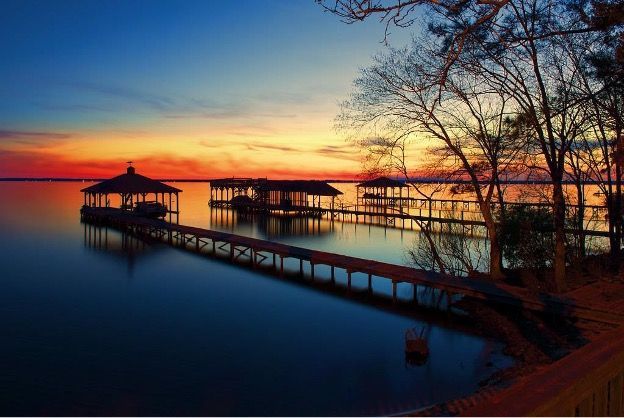
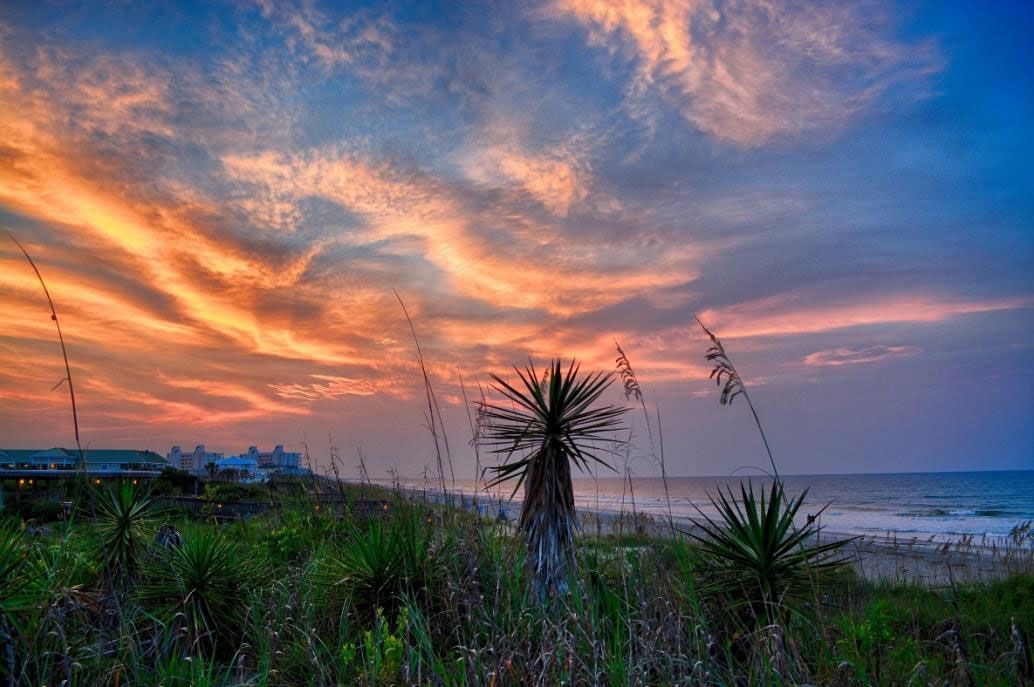
Sunset at Lake Waccamaw. Photo by Doug Sasser
What a world of wonders we live in. The existence of these bays is truly phenomenal. So far, no solid explanation for these landforms has yet been made. But hey, who says you can't come up with your own theory? Feel free to explore the Carolina Bays yourself if you may!
